Travelogue after a long time. Not that I haven't been traveling, but have been too lazy to write. However recently I went to Langtang trail upto Gosaikunda, the memoir of which is worth mentioning. The scenery along the trail is just superb and the Gosaikunda and other lakes around are just magnificent!
We (Rajendra, Subash and me) started from Sundarijal and ended up at Dhunche via Gosaikunda. Took 5 days (29th Sept - 3rd Oct, 2011) and trekked up to a height of 4730m.
Day 1
We started from Sundarijal. Actually the plan was to go to Dunche / Syabrubesi first and start from there, but since the bus tickets were hard to get due to Dashain we decided to start from the opposite end.

The Sundarijal - Chisapani was quite familiar trail. We started around noon and reached there by evening. Apart from few downhills, the trail is all the way up.
Elevation: 2194m
Day 2
Headed towards Chipling Danda. But first we went all the way downhill to Chipling Phedi then a *tough* climb to Chipling Danda. Stayed there for a while for lunch and for much needed rest.
Then towards Kutumsang, the next stop. Not as tough climb as before but still it was all the way uphill. Finally reached Kutumsang. Had some noodles there.


It was already getting late so we were in a dilemma whether to head towards Magengoth or not. But we still thought to give it a shot.
However we got caught on the way due to magnificent scenery of sunset along the way. By the time we were done taking snaps, it was already dark. Plus met a women who was the owner of a hotel at the next stop. Even she advised us to return back to Kutumsang.
Night at Kutumsang. Elevation: 3630m
Day 3:
Chilly morning, but the cute little daughter of the owner of the hotel made it interesting. She was perky, talkative and fun.
After breakfast we headed towards Magengoth. And it was tough climb. Took 3 hours to reach there. Rested for a while and we had Dhido there, which I regretted as the curry was too chilly and burned my stomach later.

Headed off to Tharepati then. Little elevated road but not that tough. Took 2 and half hour to reach there. The view of the mountains was supposed to be amazing from there, but unfortunately it was raining when we reached there. Stopped by a hotel there and had some tea.
Then off to Ghopte. The trail was all the way downhill and rocky. It was so steep we wondered how the trekkers taking the opposite route would climb that. On the way you come across a spring and a giant boulder you cannot miss.


Finally Ghopte. Had no energy to move beyond. Elevation: 3430m
Day 4:
Chilly and shivering night. We moved early in the morning. What was ahead was perhaps the toughest road we've encountered so far.


Ghopte to Laurebina Phedi was a series of tough ups and downs. The hotels at phedi are visible from quite a distance, but it took us almost 3 hours to reach there. Even the pass at the top starts being visible, but is yet too far.
Finally reached Laurebina Phedi (elevation: 3700m). Had some lunch and prepped for the final climb. We were climbing upto 4700m next so had the garlics and chocolates ready. It was supposed to take us 3-4 hours to climb. And if we're not careful enough, we might even catch altitude sickness!
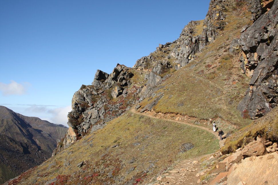
Toughest climb so far! The landscape started changing rapidly, from greenish to barren rocks. Even noticed Danphe (Lophophorus) along the way. And since the air was getting thinner, it was a slow and steady climb. Sounds of own footsteps, long breaths and wilderness. Thankfully the air was misty. Also met couple of tourists returning from the pass. Stopped by a hotel along the way for some tea! Cant believe there was a hotel in that altitude (4100m). The owner was extremely nice and the tea was cheap.


Started walking again. We all started getting headache due to cold and altitude. Finally reached the top. Frozen snow of the mountain!! And all of a sudden, the sky cleared up and it was sunny. Played with snow and took lots of photographs. Then crossed the pass (~4700m)!


Then another wonder happened. As soon as we crossed the pass, it got cloudy again and it started snowing!! Amidst the snowfall, we walked along Surya Kunda (lake), Ganesh Kunda and several others. Finally reached Gosaikunda. It goes without saying, the lake and surrounding is beautiful.


Stayed for the night there. Elevation: 4300m
Day 5:
Took a lot of snaps around Gosaikunda early in the morning. Some breakfast and then headed towards Dhunche, all the way downhill.


Took us a whole day to reach Dhunche via Laurebinayak and Sing Gompa. Having walked uphill for 4 days, the downhill walk was knee-aching. Reached Dhunche in the evening. Elevation: 1950m!


We were supposed to stay there for the night and return Kathmandu the other day, but due to festive season the buses were hard to get. Fortunately we got a jeep returning back to Kathmandu and we jumped in. Returning Kathmandu the same day (although hurriedly) seemed wiser to us than staying there for the night and getting lost the next day)
 Reached Kathmandu by 10pm. Elevation: 1400m :)
Other Useful Links:
1. Few photos on Flickr: http://www.flickr.com/photos/jwalanta/sets/72157627858559272/
2. Map: http://www.explore-himalaya.com/photo%20gallery/maps/lantang_&-Helumbu-trek.jpg (although I suggest you buy a paper map with contours and all, if you're planning to trek)
3. Detail Guide: http://www.yetizone.com/Langtang/Trek/langtang_trek.shtml


 Posts
Posts


3 almost hidden Google Gemini features you should start leveraging today
-
The Google Gemini LLM and the app have more features than you can see from
the surface. In addition to generating images, audio, and music, you can
also ...
2 months ago


